The 52°N walk is roughly 270 miles long, from Felixstowe Suffolk to Fishguard Pembrokeshire.
I’m breaking down the walk into six separate stages as shown below. Each stage averages about 45 miles and takes about a week to complete.
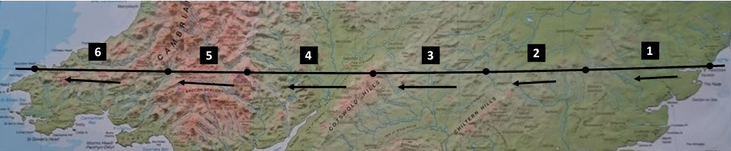
There are 32 walking days in total, spread over the six week period from late June to early August 2019.
Each day comprises an average of about 9 miles walking and a meeting at an amazing place.
Use the Stages menu above, or the links below, for details of the six separate week-long stages and the different walking days within each stage. In summary, the six stages are:
Stage 1 – Bawdsey to Audley End
51 miles from the Suffolk coast then on into Essex, with the amazing places I visit themed around construction: Tue 25 – Sun 30 Jun 2019
Stage 2 – Audley End to Bletchley
40 miles across Hertfordshire and Bedfordshire, north of the Chilterns, to Milton Keynes, with a theme of technology: Wed 3 – Sun 7 Jul 2019
Stage 3 – Bletchley to Broadway
47 miles through Buckinghamshire & Oxfordshire then the Gloucestershire Cotswolds, with a public service theme: Wed 10 – Sun 14 Jul 2019
Stage 4 – Broadway to Black Hill
52 miles in Worcestershire & Herefordshire, past the Malverns and the Wye Valley, with an historical theme: Thu 18 – Tue 23 Jul 2019
Stage 5 – Black Hill to Llandovery
32 miles into Wales, across Powys, through the Brecon Beacons National Park, with a theme of the great outdoors: Sun 28 – Wed 31 Jul 2019
Stage 6 – Llandovery to Pwll Deri
54 miles with a reflective theme, across Carmarthenshire, then to the Pembrokeshire Coast National Park: Sun 4 – Fri 9 Aug 2019
As you can see there are gaps of a few days between each stage, when I’ll come home. So at the beginning and end of each stage I’ll travel by train from Wokingham (near Reading in Berkshire) to the start point, and then back from the end point, as shown on this map: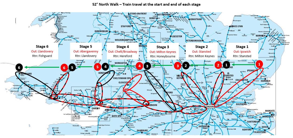 Key: Red = outward travel, Black = return travel, Red & Black = Same line used for both outward & return
Breaking up the walk into stages likes this, with outward and return rail travel at the start and end of each stage, is only possible because Britain has so many north-south rail routes at this latitude. Pre-Beeching, of course, there were even more – I’ll be crossing several disused lines on the walk.
I’m not a hardy walker so will be staying in bed & breakfast accommodation rather than camping. I’ve pre-booked 33 places to stay, shown as blue markers on this map:
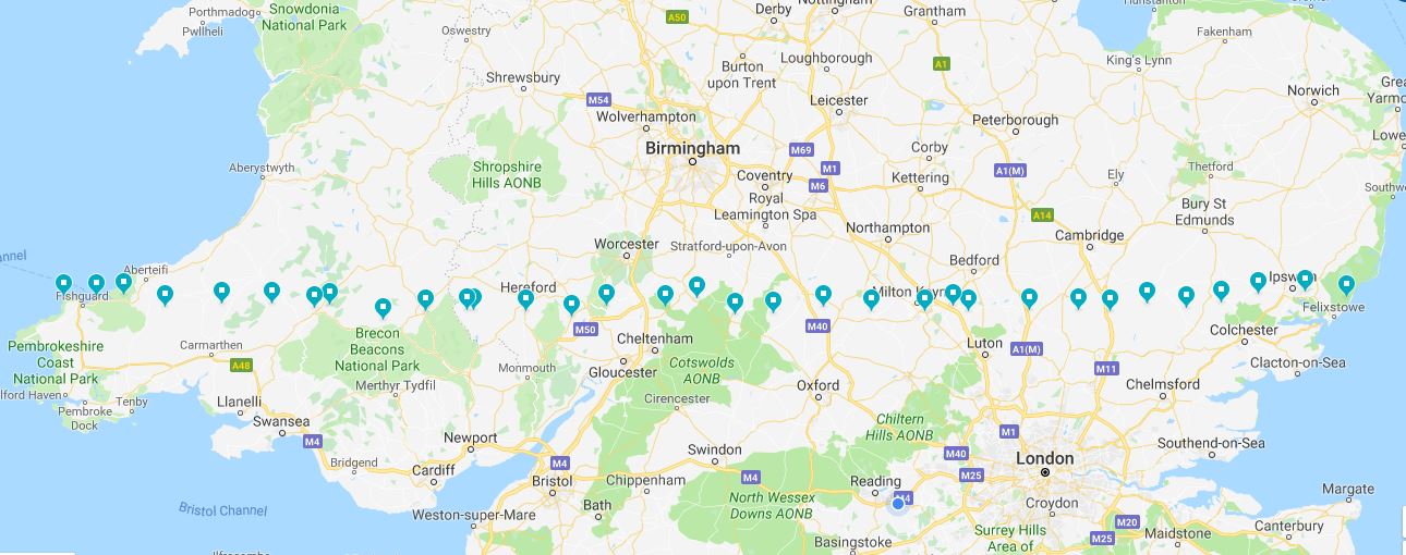
Each walking day’s page on this site shows the name of that night’s accommodation.